Downloading an offline hiking map before entering Sardinia’s Supramonte is a sensible precaution, not an optional tech trick. This rugged limestone region crosses the territories of Oliena, Orgosolo, Dorgali, Baunei and Urzulei, with deep gorges, plateaus, sinkholes and long sections where roads and settlements are scarce. A phone map can be extremely useful here, but hikers should not treat AllTrails — or any single app — as the only source of navigation.
The strongest approach is to prepare an offline route in advance and cross-check it against Sardegna Sentieri, the official hiking-network portal of the Autonomous Region of Sardinia and Forestas. The regional database currently contains dozens of Supramonte trails and also indicates validation or maintenance status for routes.
Can AllTrails maps work without mobile signal?
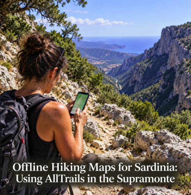
AllTrails offers offline map functionality on its paid plans, allowing eligible subscribers to save maps to a phone before a hike. The key step is to complete the download while you still have reliable Wi-Fi or mobile data rather than waiting until the trailhead.
Once the relevant map has been saved to the device, the phone’s GPS can determine your position without a mobile-data connection. That is useful in mountain terrain where reception can be intermittent or absent.
Offline mapping does not make the phone infallible. A dead battery, damaged handset, incorrect downloaded route or GPS error can still leave you without reliable navigation. Put the phone in a battery-saving configuration appropriate to your device and carry a power bank on longer hikes.
Why the Supramonte deserves extra preparation
Sardegna Sentieri describes the Supramonte as a sparsely populated landscape where communication routes are few and can be difficult to travel. The terrain includes cliffs, deep valleys known as codulas, caves, dolines and sinkholes.
The Supramonte of Urzulei is described by the regional trail portal as the wildest part of the territory. That is a useful warning for visitors accustomed to heavily signposted national parks in the United States or northern Europe.
A line visible on a crowdsourced hiking app does not necessarily mean that a route is freshly marked, straightforward on the ground or appropriate for your experience. Vegetation, erosion, private or managed access, trail maintenance and weather can all change conditions.
Cross-check AllTrails with Sardegna Sentieri
Before setting out, search the same area on the official Sardegna Sentieri portal. Its Supramonte section currently lists established routes with trail numbers, distances and estimated walking times.
Examples include trail B-401 from Oliena to Monte Corrasi, listed at 6.6 km and around 3 hours 30 minutes; B-480 from Tiscali to Campu Donianigoro, 5.2 km and around 2 hours 15 minutes; and B-502 from Sedda ar Baccas to Gorropu, 6 km and around 3 hours.
The portal also lists routes such as B-481 from S’Abba Arva to Tiscali, B-501 around Urzulei and B-405 from Scala ’e Pradu toward Gasole. These trail codes are useful because they connect your digital planning to the official regional hiking network.
Do not interpret a listed time as a promise. Walking speed varies with fitness, heat, navigation, stops and terrain, and the figures normally refer to the specific route segment rather than automatically including your return journey.
Check the trail status, not just the line on the map
One advantage of Sardegna Sentieri is that routes can carry a validation or maintenance status. The current Supramonte database includes trails described as passable, checked or validated, under verification or maintenance, and under review.
That information can be more important than a star rating on a recreational app. A route uploaded by another hiker may remain visible online even when local conditions have changed.
Check the official route page shortly before departure. If a route is under maintenance or verification, investigate further rather than assuming that an old GPS track proves it is currently suitable.
Official PDF maps can add another layer
Sardegna Sentieri also publishes detailed itinerary guides. Current downloadable material includes the multi-stage Dal Supramonte al mare route and Dal Gennargentu al Supramonte, with topographic mapping, trail classifications and route information.
Saving relevant official PDFs to the phone provides a second offline reference independent of the hiking app. Take screenshots of critical junctions, access roads and route notes as well, especially if the PDF viewer itself normally depends on cloud storage.
For serious or remote routes, a paper topographic map and compass remain valuable backups. They do not need a battery, but they only help if you know how to use them.
Download more area than you think you need
Do not save only a narrow strip around the planned trail. An unexpected wrong turn, closed access point or emergency descent can push you beyond the downloaded map area.
Before leaving Wi-Fi, make sure your offline coverage includes the trailhead, approach road, entire hiking route, nearby junctions and enough surrounding terrain to understand alternative exits. Open the saved map once in offline or airplane mode to confirm that it actually loads.
Save the parking location separately. In remote parts of Sardinia, navigating back to the rental car after sunset can be surprisingly difficult if the trailhead is reached along an unpaved forest or mountain road.
Do not rely on Google Maps for mountain trails
Google Maps can be useful for driving to towns and some access points, but a road-navigation app is not a substitute for a hiking map in the Supramonte. Some tracks visible on general mapping services may be private, unsuitable for ordinary cars or unrelated to the marked hiking network.
For driving, download an offline road map of the surrounding part of Sardinia as a separate backup. For walking, use dedicated hiking mapping and official trail information.
Popular Supramonte routes still require judgment
Tiscali, Monte Corrasi, Gorropu and routes toward Cala Luna are among the names travelers frequently encounter when planning hikes in the area. They are not interchangeable in difficulty or logistics.
For example, Sardegna Sentieri lists the Ghenna ’e Peta–Cala Luna trail B-181 at 15.8 km and about four hours for the route segment. Its official multi-stage routes toward the coast are classified at intermediate-high hiking difficulty. A coastal destination that looks close on a map can therefore involve substantial limestone terrain and complicated return logistics.
Never choose a route solely because the photos are attractive or because another user completed it quickly. Confirm distance, elevation, difficulty, return plan and current conditions for the exact route you intend to follow.
Heat and water can be bigger problems than navigation
Offline maps cannot solve dehydration. Much of the Supramonte is exposed limestone terrain, and summer temperatures can make a route considerably more demanding. Springs shown on maps should not automatically be assumed to provide safe, reliable drinking water year-round.
Carry enough water for the route and conditions, start early when appropriate and check the weather forecast. After heavy rain, normally dry channels and gorges can present different hazards; in hot weather, exposed climbs can become punishing.
If your route involves canyon terrain, technical passages or remote areas unfamiliar to you, a qualified local guide may be more valuable than any navigation app.
An offline-map checklist for the Supramonte
- Download the AllTrails or other hiking-app map while you have reliable internet.
- Test that the map opens with mobile data switched off.
- Cross-check the route and trail number on Sardegna Sentieri.
- Read the current validation or maintenance status where available.
- Save relevant official PDF maps or route notes offline.
- Download a wider area than the exact GPS track.
- Save the trailhead and vehicle location separately.
- Carry a charged power bank and suitable cable.
- Tell someone your planned route and expected return time.
- Carry enough water and do not depend blindly on mapped springs.
AllTrails can be a useful part of hiking preparation in Sardinia, particularly when its maps are saved offline before entering the mountains. In the Supramonte, however, the safest habit is redundancy: app map, official Sardegna Sentieri information, saved route details and a backup navigation method.
The Supramonte is precisely the kind of landscape that makes Sardinia extraordinary on foot. Its isolation is also why a blue GPS dot should never become your entire safety plan.