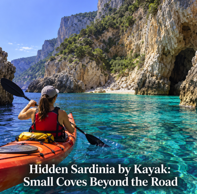
Travelers searching for a “secret map” of Sardinian coves accessible only by kayak are really looking for something slightly different: tiny landings, caves and rocky inlets that sit between the famous beaches and are easily missed from the road. Sardinia has many stretches of coast where a kayak can explore at a scale that ferries and larger excursion boats cannot. The Gulf of Orosei is the clearest example, but the idea of a completely secret, kayak-only beach needs some correction. Many celebrated coves can also be reached by boat, and several have difficult hiking approaches from inland.
The real advantage of a kayak is not exclusivity. It is the ability to paddle slowly beneath cliffs, investigate small inlets and stop at places that are inconvenient for larger boats, while avoiding the noise and speed of a motor.
Cala Gonone: the best starting point for small coves
South of Cala Gonone, the road follows the coast only as far as Cala Fuili. SardegnaTurismo describes Cala Fuili as the last cove reachable by car or bicycle from Cala Gonone; beyond it, the Gulf of Orosei becomes a landscape of cliffs, canyons, caves and beaches reached mainly by sea or demanding trails.
For paddlers, however, the interesting section starts even before Cala Fuili. Local kayak guidance identifies Cala Ziu Santoru and Cala Oddoana as suitable objectives for a day outing from Cala Gonone. They are much less famous than Cala Luna and precisely the sort of small coastal places people imagine when searching for hidden kayak coves.
A typical out-and-back itinerary from the central beach of Cala Gonone toward Ziu Santoru, Oddoana and the Bue Marino cave area is around 10 kilometres in total. Local rental guidance describes this as a reasonable first full-day test for newcomers, provided sea conditions are suitable.
Cala Ziu Santoru and Cala Oddoana
These two small coves are among the most interesting answers to the “secret Sardinia” idea because they sit along a spectacular coastline without the global name recognition of Cala Luna, Cala Mariolu or Cala Goloritzé.
Kayakers leaving Cala Gonone can follow the limestone coast south, with the cliffs providing a continuous visual reference. Current local kayaking itineraries specifically recommend stopping at Ziu Santoru and Oddoana and describe them as small pearls of the Gulf of Orosei.
They should not be treated as guaranteed private beaches. Small boats and other paddlers can arrive, particularly in high summer. Their appeal is that they are secondary stops on a coast where most traffic is focused on the headline beaches farther south.
Conditions also decide whether landing is sensible. A tiny pebble cove can become difficult when swell reaches the shore, even if paddling offshore still feels manageable.
The caves between Cala Gonone and Cala Luna
Kayaking is especially rewarding along the limestone wall because the coast is punctured by cavities and sea-level openings. Some can be approached closely in calm water, while others should be viewed from outside depending on sea state, restrictions and local instructions.
The Grotta del Bue Marino is the famous cave system on this section. It is not a secret kayak destination: it is a major visitor attraction with regulated guided visits. But paddling the coast around the cave area reveals smaller features that are easy to miss from a passenger boat.
Do not enter an unfamiliar sea cave simply because the opening looks calm. Swell can amplify against rock walls, boat traffic may appear unexpectedly, and some caves have protected or regulated access.
Cala Luna is beautiful, but it is not kayak-only
Cala Luna is an obvious paddling objective from Cala Gonone, but it should not be sold as a hidden beach. It can be reached by excursion boats and by hiking routes as well as by kayak.
Its importance for kayakers is different: it provides a major landmark and possible turnaround point on a longer route. Guided itineraries currently operate multi-day or overnight paddles between Cala Gonone and Cala Luna, stopping at smaller coves such as Ziu Santoru and Oddoana when sea conditions permit.
A current guided two-day itinerary covers roughly 14 kilometres by kayak and about six hours on the water, illustrating how quickly distances accumulate when exploring rather than simply paddling point to point.
Farther south: spectacular, but not a beginner day paddle
South of Cala Luna are Cala Sisine, Cala Biriola, Cala Mariolu, Cala dei Gabbiani and Cala Goloritzé. This is some of Sardinia's most dramatic coastline, but the distances and exposure make it a different category of trip.
SardegnaTurismo notes that Cala Biriola can also be reached by a demanding route through the Supramonte, Cala Mariolu has an expert hiking approach, and Cala Sisine can be reached after a long trek. In other words, these places are remote but not literally accessible only by kayak.
The Piscine di Venere and smaller cliffside inlets around this southern section are particularly attractive from the water. Small craft can explore the coastline more intimately than large excursion vessels, but a long independent paddle here requires real sea-kayaking judgment.
There are few easy exits once you commit to an exposed limestone coast. Wind, swell and fatigue matter more than how attractive a cove looks on a map.
Why a “secret map” can be dangerous
A pin dropped on a beautiful inlet tells you almost nothing about whether it is safe to reach by kayak. It does not show the day's wind, rebound from cliffs, boat traffic, landing conditions or whether a protected zone restricts access.
It can also create the wrong expectation that an unnamed or little-known beach is automatically open for landing. Sardinia includes marine protected areas and sensitive coastal habitats where navigation, anchoring, access and commercial activities can be regulated.
For that reason, a useful kayak map should show launch points, distances, exposed sections, legal restrictions and possible exits — not just “secret beaches.”
Tavolara and Punta Coda Cavallo: check the zoning first
The Tavolara–Punta Coda Cavallo Marine Protected Area protects more than 15,000 hectares of sea and a long stretch of northeastern Sardinian coastline. Its scenery naturally attracts kayakers, particularly around Porto Taverna, Porto San Paolo and Capo Coda Cavallo.
But this is exactly the kind of place where paddlers should consult the official zoning map before setting off. The protected area has Zones A, B and C with different rules. Zone A is a full reserve with particularly strict access restrictions, while other zones regulate activities and anchoring.
The managing authority's current rules also prohibit activities that can compromise the protected environment, and commercial operators working within the marine protected area may require authorization. A social-media map should never override the official protected-area map.
What to carry for a cove-hunting paddle
Even a short coastal outing should be treated as a small marine journey. Wear a buoyancy aid rather than storing it inside the kayak. Carry enough drinking water, sun protection, a charged phone in a waterproof case and a dry bag for essential items.
A rental should provide the kayak, paddle and required safety equipment; local Cala Gonone rental information also mentions waterproof containers for documents and phones. Ask specifically what is included before leaving.
For longer independent routes, experienced paddlers should plan for self-rescue, changing wind and the possibility that a planned landing is unusable. Beginners are better served by a guide or by a short route with a conservative turnaround point.
When kayaking works best
Early starts are valuable for more than avoiding crowds. They give you more daylight and can allow you to complete the route before afternoon wind becomes a problem. Conditions vary by day, so there is no universal “safe morning” rule.
Before launching, check an official marine forecast and ask the local rental or guide about the specific coast. A forecast for Cala Gonone town does not fully describe the sea farther south beneath exposed cliffs.
If the operator advises against going out, change the plan. A hidden cove is not worth turning a holiday paddle into a rescue.
The Sardinia that kayaks reveal
The most rewarding kayak discoveries are often not the beaches that dominate travel guides. They are the small pebble landings between them, a shallow turquoise pocket beneath a cliff, or a cave entrance viewed quietly from the water.
From Cala Gonone, Ziu Santoru and Oddoana offer a realistic introduction to this style of exploration without pretending that they are undiscovered. Stronger paddlers can extend toward Cala Luna, while experienced sea kayakers and guided groups can explore deeper into the Gulf of Orosei.
The right mindset is not to collect secret coordinates. It is to read the coast slowly, respect protected areas and let weather and sea conditions decide how far you go. That is where a kayak gives Sardinia something a road map cannot.