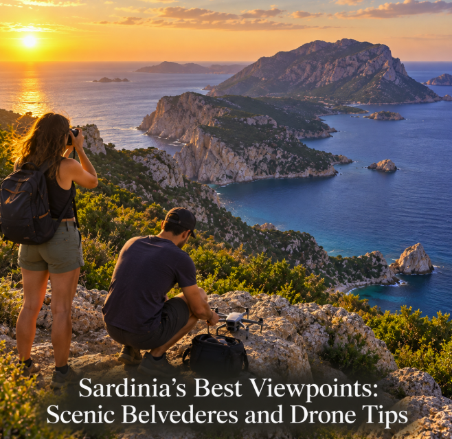
Sardinia is unusually generous with viewpoints: cliff roads, mountain passes and coastal belvederes can reveal entire stretches of shoreline without requiring a drone at all. For aerial photographers, however, a beautiful launch point is not automatically a legal flying location. Italian drone rules require pilots to check the official D-Flight geographical-zone map before every flight, and restrictions around airports, protected areas and other sensitive zones can change what is possible at some of the island’s most photogenic places.
A useful Sardinia viewpoint itinerary therefore starts on the ground. Choose a belvedere for its landscape first, then check whether drone operations are permitted at that exact location and on that date.
Capo Caccia and the Alghero coast
West of Alghero, the road toward Capo Caccia is one of Sardinia’s classic panoramic drives. Limestone cliffs, the open Mediterranean and the protected landscape around Porto Conte create viewpoints that work particularly well near sunset. The Belvedere di Foradada area is known for views toward the offshore Isola Foradada, while the Capo Caccia promontory provides a dramatic sense of height above the sea.
Drone pilots need to be especially careful here. The wider Capo Caccia–Isola Piana territory is part of a protected area, and the Alghero region also contains airport-related airspace. Do not assume that being on a remote-looking cliff makes a flight legal. ENAC requires pilots to check the current UAS geographical zones on D-Flight before each operation. citeturn0search0turn0search2
Nebida and the southwest mining coast
The coast around Nebida and Masua is one of the strongest landscapes for conventional photography. From elevated positions around Nebida, the coastline breaks into cliffs and sea stacks, with Pan di Zucchero forming the most recognizable offshore landmark. Farther north, Porto Flavia adds Sardinia’s mining heritage to the same coastal scenery.
This area is particularly effective in late-afternoon light because the west-facing coast catches the sunset. A ground-level camera can produce wide images with cliff paths or old mining structures in the foreground and the sea beyond, so there is no need to launch a drone merely to obtain a sense of scale.
If flying, check the exact point rather than relying on generic online lists of “drone spots.” ENAC states that geographical UAS zones can be established for aviation safety, security and environmental protection, and the official map is the reference pilots must consult. citeturn0search0turn0search1
Baunei and the Ogliastra mountains
For a completely different perspective, the roads and high ground around Baunei combine limestone mountains with distant views toward the Gulf of Orosei. The appeal here is depth: ridges descend toward the sea while Mediterranean vegetation and exposed rock provide strong foregrounds.
Baunei is also a good reminder that some of Sardinia’s most spectacular landscapes overlap with environmentally sensitive territory. Coastal and mountain viewpoints may sit near protected habitats, so a drone pilot should never infer permission from the absence of buildings or crowds.
Castelsardo for town-and-coast views
Castelsardo is a useful option when the objective is a panoramic photograph with an unmistakable human element. The medieval town occupies a rocky headland on Sardinia’s north coast, with tightly packed houses rising toward the castle. Views from surrounding roads and elevated positions can place the historic center against the Gulf of Asinara.
For drone work, built-up areas introduce additional considerations involving uninvolved people and the operating subcategory of the aircraft. ENAC’s Open Category rules prohibit flights over assemblies of people and require the appropriate safety distances from people not involved in the operation. citeturn0search4turn0search8
Capo Coda Cavallo and Tavolara
Northeast Sardinia offers another instantly recognizable composition: the coastline around Capo Coda Cavallo facing Tavolara. From ground viewpoints, Tavolara’s limestone mass dominates the horizon and works at both sunrise and during clear daytime conditions.
The surrounding sea belongs to the Tavolara–Punta Coda Cavallo Marine Protected Area, so this is exactly the kind of location where photographers should verify current geographical restrictions rather than treating a scenic viewpoint as an automatic drone launch site. ENAC explains that park-related flight restrictions are published through D-Flight when approved, and pilots must use the platform to determine the current status of the intended operation. citeturn0search0
What drone pilots need to know in Sardinia
Italy follows the European UAS framework. For Open Category operations, ENAC requires operators to verify the D-Flight map before each flight. Registration on D-Flight and liability insurance are required in the circumstances set out by the Italian rules; even operators using a camera-equipped drone below 250 grams remain subject to registration, insurance and geographical-zone requirements, although a remote-pilot certificate is not required for that sub-250-gram Open Category case. citeturn0search2turn0search13
Open Category pilots must remain below 120 metres from the ground or nearest surface, maintain visual line of sight and avoid assemblies of people. The applicable separation from uninvolved people depends on the drone and subcategory. citeturn0search4turn0search8
Visitors arriving from the United States or another non-EASA country should pay particular attention to certification. ENAC states that a remote-pilot certificate issued under a non-EU national system is not automatically recognized for Open Category operations in Italy; where an A1-A3 or A2 certificate is required, the pilot needs a certificate issued within the EASA system. citeturn0search12
Airport zones are another major issue. ENAC notes that geographical zones established for aviation safety protect airports, heliports and similar facilities, and Open Category operations are prohibited in safety geographical zones. This is particularly relevant around destinations such as Olbia and Alghero, where attractive coastline may also be relatively close to active aviation infrastructure. citeturn0search0
The best viewpoint may be the one where the drone stays packed
Sardinia’s belvederes are valuable because many already provide the elevated perspective drone photographers are trying to create. Capo Caccia offers cliffs and open sea, Nebida layers mining landscapes against sea stacks, Baunei gives mountain-to-coast depth, Castelsardo adds historic architecture and Capo Coda Cavallo frames Tavolara from the shore.
Use these places first as viewpoints. If you want to fly, open D-Flight at the location before takeoff, check the current zone and altitude conditions, confirm that your registration, insurance and pilot requirements are in order, and consider people, wildlife and local conditions. A legal flight yesterday is not proof that the same flight is permitted today.
That approach produces better travel photography as well as safer flying: choose the landscape for the image, and only then decide whether a drone genuinely adds something to the view.